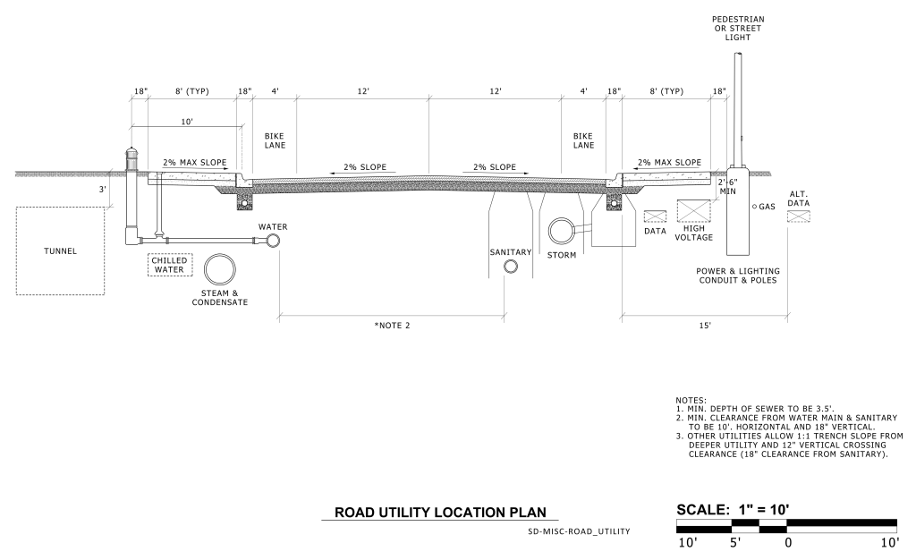
A technical blueprint of a road utility location plan. It displays cross-sectional details of a road with various utilities underneath. The road includes a bike lane and pedestrian or street light. Multiple subsurface utilities are outlined, including chilled water, steam and condensate, water, sanitary, storm, data, high voltage, and gas. The blueprint also indicates a tunnel section. Dimensions are carefully marked, showcasing the distance between different sections and the slopes of the road. The plan specifies a 2% maximum slope for bike lanes and other road sections. Additional notes detail minimum depth and clearance requirements for utilities.
Additional Formats
Additional formats provided for print or third party applications: